| Search JoyZine with Google Site Search! |
Australia Decoded
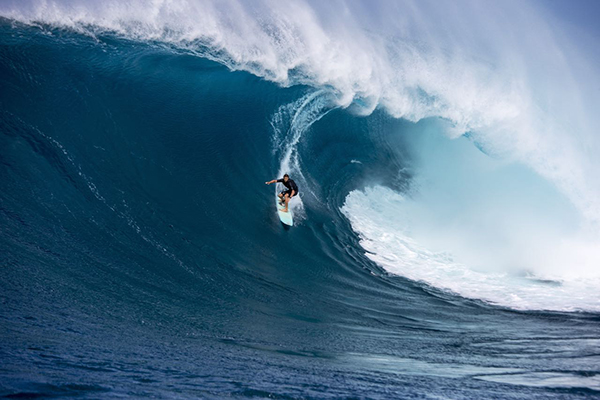
Baw Baw berry—Wittsteinia vacciniacea, a shrub species in the family Alseuosmiaceae. Endemic to the Baw Baw Plateau in Victoria, the berry grows in sub-alpine and riparian areas. It grows to about 40cm high and has leaves which are between 1-5cm long. The fragrant flowers are between 4.5 and 7mm long and are followed by greenish-white rounded fruits. The species was first formally described by botanist Ferdinand von Mueller in Fragmenta Phytographiae Australiae in 1861. It occurs on the edge of rainforest and in sheltered woodland in the Eastern Highlands of Victoria. Baw Baw frog—Philoria frosti, a subalpine frog in serious decline. This endangered species is confined to an area about 80sq km on the Baw Baw Plateau in eastern Victoria. Adults had, until recently, been thought to be restricted to alpine heath and grassland. They have now been found within the moist eucalypt forests which border the plateau. Tadpoles are aquatic, in alpine bogs and seepages. Eggs may be spawned in saturated sphagnum bogs that later flood. Males call from the ground, concealed in wet cavities in sphagnum moss, and under fallen debris. The call is quite variable, a series of harsh pulsing notes with the first note often the longest. The current population size of adult males is estimated to be 1-2% of the 10,000-15,000 estimated to be on the Baw Baw Plateau in 1983 and 1984. Baw Baw National Park—covers a substantial part of the Baw Baw Plateau and sections of two river valleys. The extensive plateau of grassy snow plains, a contrast to the steep river valleys, is punctuated by mountainous peaks. The park protects a range of significant plant communities in the alpine environment, forest and river areas. Trees include alpine ash, mountain ash, snowgum, messmate, myrtle beech and various stringybarks. Baw Baw berry, endemic to this region, occurs on the plateau. As well as the more common wombats, echidnas, possums, lyrebirds and cockatoos, the park is home to the endangered Leadbeater's possum and Baw Baw frog. Located in Victoria. Baw Baw Plateau—an extensive plateau of grassy snow plains punctuated by peaks such as Mount Baw Baw, Mount St Gwinear and Mount Erica. The alpine meadows in early summer are bright with wildflowers among twisted snow gums, and the long-distance Australian Alps Walking Track crosses the plateau. The park includes Victoria's first long-distance walking track, cut by the Public Works Department in 1906 between Walhalla and Warburton. Baxter's kunzea—Kunzea baxteri, an erect shrub to about 1.5—3 metres in height with grey-green, oblong leaves to about 15mm long. The large, crimson flower clusters are arranged in "bottlebrush" configuration and are very profuse and conspicuous. The flowers are followed by small 1-celled fruits which release numerous small seeds when ripe. Bay of Fires Conservation Area—on Tasmania's East Coast the bay extends from Binalong Bay in the south to Eddystone Point in the north. This unusual name was given to the area by Captain Tobias Furneaux, in 1773, when he noticed numerous fires along the coast. This led him to believe that the country was densely populated. Abundant evidence of this occupation by Aboriginal people can be seen along the coast today. A scenic view of the bay can be glimpsed by driving along the coast to The Gardens. This picturesque area was named by Lady Jane Franklin, the wife of Governor John Franklin, who spent some time in the region. The northern section of the Bay, from north of the outlet of Ansons Bay to Eddystone Point lies within the Mt William National Park. The middle section of the Bay of Fires lies in the vicinity of Ansons Bay. It can be accessed via Policemans Point or the northern shore of Ansons Bay, however be aware that it is not possible to cross the outlet of Ansons Bay. The southern section of The Bay of Fires is in the Conservation Area, situated along a 13km stretch of coast between Binalong Bay and The Gardens. Bay of Islands Coastal Park—stretches from Peterborough almost to Warrnambool in a 32km-long narrow strip. The park has spectacular ocean views and many other memorable features. It protects a variety of rare and threatened flora and fauna species in its coastal heathland environment. Halladale Point is named for the shipwreck of the Falls of Halladale, which ran onto the reef off the point in 1908. But Halladale Point has another name—Massacre Point. Rumour has it that Europeans killed a group of the Kirrae-Wurrong Aborigines here by driving them off the cliff. The story continues that the women and children of the group were then killed in the nearby swamp at Massacre Bay. The Aboriginal population of the area dropped from several hundreds in the 1840s to three or four by the 1880s. As if to sharpen this tragic tale, at Halladale Point you can look across to the whitened heap of shellfish on top of a nearby isle and reflect on the wealth and diversity of food available to the Aboriginal people from the estuaries, sandy beaches, rock platforms and heathland around here. The rufous bristlebird, with its uptilted tail, is common in small remnants of the heathland, feeding and nesting in the dense sword grass tussocks, coastal beardheath, banksias and daisy bushes. The heathland is colourful in spring, when dense yellow banksias, rich pink Swainson's pea, pigface, golden groundsel and purple flag lilies are flowering. Gleaming spikes of rare metallic sun orchids, along with fairies' aprons, greenhoods and donkey orchids are also found in Bay of Islands Coastal Park. bay window—stomach, especially a paunch. Baz/Bazza—nickname for a person named Basil or Barry. be blowed—1. (exclamation) no!; I refuse! 2. (curse) be damned: e.g. Be blowed if I'll ever help him again! be sold a pup—be cheated, hoodwinked, conned or tricked. be there with bells on—arrive with enthusiasm. be with you in a tick—one moment, please: e.g., Hang on, he'll be with you in a tick. Derived from 'one tick of the clock'. be-all and end-all—the whole being or essence; a thing or concept of paramount importance to someone. beach hibiscus—Hibiscus tiliaceus, a small tree, 5-8m high, commonly found in monsoon pockets along the coast and river banks. Hibiscus tiliaceus is a species of flowering tree in the mallow family, Malvacea, that is native to the Old World tropics. The specific epithet, "tiliaceus", refers to its resemblance to the related Tilia species. H. tiliaceus reaches a height of 4-10m, with a trunk up to 15cm in diameter. The flowers of H. tiliaceus are bright yellow with a deep red centre upon opening. Over the course of the day, the flowers deepen to orange and finally red before they fall. The branches of the tree often curve over time. H. tiliaceus is a common coastal plant in Eastern and Northern Australia, Oceania, Maldives and Southeast Asia. It is uncertain if the species is native to Hawaii, as it may have been introduced by the Polynesians. H. tiliaceus can be found at elevations from sea level to 800m in areas that receive 900-2,500mm of annual rainfall. It is commonly found growing on beaches, by rivers and in mangrove swamps. Beach hibiscus is well adapted to grow in a coastal environment in that it tolerates salt and waterlogging and can grow in quartz sand, coral sand, marl, limestone and crushed basalt. It grows best in slightly acidic to alkaline soils (pH of 5-8.5). The plant lends its name to a coastal community in Cotton Tree, Queensland. The wood of H. tiliaceus has a specific gravity of 0.6. It has been used in a variety of applications, such as seacraft construction, firewood and wood carvings. Its tough bark can be made into durable rope and used for sealing cracks in boats. The bark and roots may be boiled to make a tea to cool fevers, and its young leafy shoots may be eaten as vegetables. Native Hawaiians used the wood to make ʻiako (spars) for waʻa (outrigger canoes), mouo (fishing net floats), and ʻau koʻi (adze handles). Kaula ʻilihau (cordage) was made from the bast fibers. Hau would be used to make ʻama (canoe floats) if wiliwili (Erythrina sandwicensis) was unavailable. H. tiliaceus is widely used in Asian countries as a subject for the art of bonsai, especially Taiwan. The finest specimens are taken from Kenting National Park. Lending itself to free grafting, the leaf size is reduced fairly quickly. Cyanidin-3-glucoside is the major anthocyanin found in flowers of H. tiliaceus. Leaves of H. tiliaceus displayed strong free radical scavenging activity and the highest tyrosinase inhibition activity among 39 tropical plant species in Okinawa. With greater UV radiation in coastal areas, there is no evidence that leaves and flowers of natural coastal populations of H. tiliaceus have stronger antioxidant properties than planted inland populations. Also known as sea hibiscus, coastal (or coast) hbiscus, coastal (or coast) cottonwood, green cottonwood, native hibiscus, native rosella, cottonwood hibiscus, kurrajong, sea rosemallow, Norfolk hibiscus. beach spinifex—Spinifex sericeus, an herbaceous, stabilising plant tolerant of strong winds, sandblast, salt spray and occasional inundation by seawater. Frontal dunes have been reclaimed from bitou bush infestation by beach spinifex colonisations started ten years ago. Such areas are now claimed to have acquired healthy, low coastal shrub associations such as native pig face, guinea flower and goatsfoot. Also known as coastal spinifex. beach thick-knee—Esacus neglectus, formerly Esacus magnirostris, a large, ground-dwelling bird endemic to Australasia and the islands of South-east Asia. It is less strictly nocturnal than most stone-curlews, or thick-knees, which are a group of largely tropical waders in the family Burhinidae, and can sometimes be seen foraging by daylight, moving slowly and deliberately, with occasional short runs. It tends to be wary and fly off into the distance ahead of the observer, employing slow, rather stiff wing beats. The beach thick-knee is a resident of undisturbed open beaches, exposed reefs, mangroves, and tidal sand or mudflats over a large range, including coastal eastern Australia, though it is uncommon over most of its range, and rare south of Cairns. A single egg is laid just above the high tide line on the open beach, where it is vulnerable to predation and human disturbance. The beach thick-knee is classified as Vulnerable. Beadell, Len—Australian explorer, surveyor, engineer and author. Best-known for building the Gunbarrel Highway. He developed over 6000km of roads through 2.5 million square kilometres of the vast, empty areas of Central Australia, opening up more than 2.5 million square kilometres of the Great Sandy Desert, Gibson Desert and Great Victoria Desert. He and his Gunbarrel Construction party spent months at a time in areas that no white man had ever explored. Mining, pastoralism and eventually tourism followed in his wake. Born at West Pennant Hills, NSW in 1923, Len Beadell moved to Salisbury to work for the government after World War II, and was responsible for surveying and selecting sites for the Woomera Rocket Range, the Emu Atomic Test Site, and the Maralinga Atomic Test Site. beak—1. nose. 2. policeman. 3. private investigator. 4. magistrate. beanfest—lavish feast or celebration. beano—a feast: from "bean feast", an annual feast given to workmen by their employers in 19th century England. bearded dragon—1. Pagona barbeta is a moderate-sized lizard from south and central Australia. It prefers arid, rocky, semi-desert regions and arid open woodlands. They have a throat pouch that puffs when the dragon is excited. The puffed up effect is even more spectacular with the spikes formed from modified scales. The beard turns deep black when puffed out. Bearded dragons are very social animals. They demonstrate highly complex behavior and social interaction, including gestural language. 2. Amphibolurus barbatus, found in the eastern and south-eastern parts of Australia, excluding Cape York and Tasmania. bears—police (in the jargon of long-distance truck drivers). beat up—an exaggeration; much ado about nothing. beaten at the post—defeated at the last moment (from horse racing). beaten by a blow—shearer slang, running shears from one end of sheep to the other. Used in the song 'Click Go the Shears'. Beauchamp Falls—(locally pronounced 'Beecham') the walk to the falls and back (1hour) passes through a Douglas fir plantation. Near the river is a magnificent forest with large myrtle beech trees, blackwoods and thick ferns. The track becomes steep before opening onto the falls crashing over a ledge to a large pool. Located in the Aire Valley, Victoria. Beaudesert—a small town nestled in rolling hills, located on the Mount Lindesay Highway, some 74km south of Brisbane, Queensland. The area sources its income predominantly from rural activities such as cropping, grazing and equine activities, as well as tourism. The town was settled in 1847 and has grown to a small, bustling centre. Beaudesert is a regional hub serving surrounding communities such as Rathdowney, Kooralbyn, Canungra, Tamborine Mountain and Jimboomba. The town of Beaudesert is located 46m above sea level and has an average annual rainfall of around 916mm per year. The temperature is around thirty degrees C in summer and falls to around three degrees in winter. Generally the weather is mild but some severe storms arrive each summer. The town is possibly named after Beau Desert Park, the property of Charles Henry Alexander Paget, 6th Marquess of Anglesey in Staffordshire, England. Yet it is certain that Queensland's Beaudesert was named in about 1841 or 1842 by 'Ned Hawkins', or Edward Brace Hawkins (1821–1849), who was claiming the area as a sheep station on behalf of his employer William Henry Suttor senior (1805-1877) at Bathurst. Ned Hawkins moved on, not long after taking up Beaudesert station, to take up Boonara Station in the South Burnett. The town was originally set out in a grid pattern; however, several of the streets followed cart tracks. The area was originally settled for growing cotton and sheep. However, the area is also notoriously short of water and the cotton was not a successful crop. Hoop pine was very successfully collected from the area. In 1863 the cotton workers were indentured labourers from the South Sea Islands, the first such use in Queensland. In the 1880s, the Cobb and Co coaches ran between Beaudesert and Jimboomba. In 1885, the Beaudesert railway line was being pegged out and the railway was opened in 1888. Timber, cattle and dairying were the main industries in the area. Even though the area was known as Beau-desert (beautiful desert), the droughts and the floods were continuous problems in the area. In times of flood, houses, animals and people were washed away. The damage caused by floods is often recounted in historical documentation. Located in the Beaudesert Historical Museum is the Milbanks Pioneer Cottage. This cottage was originally built in 1875 by Patrick Milbanks on his Kerry property, out of local hand hewn timbers, slats and shingle roof. It has a four-poster bed, large cedar sideboard and numerous articles that portray the life of the early pioneers. In 1842 Edward Hawkins took up 50 000 acres of farmland extending from the coast to the Logan River, 64km south of Brisbane and 72km inland from the Gold Coast. He named his pastoral station Beaudesert, after a station at Mudgee owned by Henry Bailey. The town of Beaudesert developed around the homestead. beaut—1. anything exceptional, excellent. 2. pertaining to approval or delight; e.g. You beaut! You've won the Lotto! Beautemps-Beaupré, Charles-François—chief hydrographer of the d’Entrecasteaux expedition. His highly accurate map of the previously uncharted coasts of South Australia and Victoria remained unchanged until the Baudin and Flinders expeditions (1800–4 and 1801–3, respectively). beautiful—1. delicious. 2. delightful. beautiful firetail—Emblema bellum, a large, robust finch. Males have an olive-brown crown and back which is finely barred in black. Underparts are grey with a fine black barring. Black stripe on forehead extending to surround the eyes. Rump and upper tail coverts bright crimson. Centre of belly and undertail coverts black. Eyes are hazel with light blue periopthalmic ring. The bill is red, and the legs and feet pink-brown. Females resemble males but lack the black patch in the centre of the belly. Beautiful firetails are shy, solitary and elusive birds which live in permanent pairs. They frequent dense cover and sleep in roosting nests at night. Length: 120-130mm. Subspecies: None. Status: In the wild—uncommon to rare. Distribution: Tasmania. It also has a fragmented mainland distribution from Sydney (NSW) to Adelaide and Kangaroo Island. Habitat: Cool temperate heath, melaleuca thickets and swamps (seldom far from water). Diet: Half-ripe grass seeds and seeds from trees and shrubs, supplemented with insects gleaned from foliage. Breeding: October-January. The nest is flask-shaped with an entrance tunnel, constructed from green grass and small twigs. Both parents incubate and rear the young. Beautiful firetails reach sexual maturity and are capable of breeding at around 9-12 months of age. Also known as firetail finch. beautiful wren—(see: blue-breasted fairy-wren). beauty!—an enthusiastic expression of pleasure or agreement. Bedarra Island Resort—an exclusive haven off the Queensland coast, catering to those who desire 5-star accommodation and service. Fifteen villas are secluded in the island's rainforest, each with magnificent views of the water from the balcony. Accommodates up to 30 guests. Sporting activities are available. bedroom bandicoot—a sexually promiscuous male (New South Wales). bedsit—a one-roomed unit of accommodation usually consisting of combined bedroom and sitting-room with cooking facilities. bee's dick—anything small or insignificant; the smallest measure of something. bee-eater—a group of near-passerine birds in the family Meropidae. Most species are found in Africa and Asia but others occur in southern Europe, Australia, and New Guinea. They are characterised by richly coloured plumage, slender bodies, and usually elongated central tail feathers. All have long, downturned bills and pointed wings, which give them a swallow-like appearance when seen from afar. There are 26 different species of bee-eaters. As the name suggests, bee-eaters predominantly eat flying insects, especially bees and wasps, which are caught in the air by sallies from an open perch. While they pursue any type of flying insect, honey bees predominate in their diet. Hymenoptera (ants, bees and wasps) comprise from 20% to 96% of all insects eaten, with honey bees comprising approximately one-third of the Hymenoptera. Before eating its meal, a bee-eater removes the stinger by repeatedly hitting and rubbing the insect on a hard surface. During this process, pressure is applied to the insect thereby extracting most of the venom. Notably, the birds only catch prey that are on the wing and ignore flying insects once they land. Bee-eaters are gregarious. They form colonies by nesting in burrows tunnelled into the side of sandy banks, such as those that have collapsed on the edges of rivers. Their eggs are white and they generally produce 2-9 eggs per clutch (depending on species). As they live in colonies, large numbers of these holes are often seen together, white streaks from their accumulated droppings accentuating the entrances to the nests. Most of the species in the family are monogamous, and both parents care for the young, sometimes with the assistance of other birds in the colony, a behavior considered unusual for birds. The bee-eaters are a fairly uniform group, morphologically. They share many features with related Coraciiformes such as the kingfishers and rollers, being large-headed (but not as large-headed as their relatives) short-necked, brightly plumaged and short-legged. Their wings may be rounded or pointed, with wing shape closely correlated with foraging habitat and migratory tendencies. Shorter, rounder wings are found on species that are sedentary and make shorter foraging flights in denser forests and reedbeds. Those with more elongated wings are more migratory. All the bee-eaters are highly aerial. They take off strongly from perches, fly directly without undulating, and are able to change directions quickly. Bee-eaters rarely hover, however. The bill can bite strongly, particularly at the tip, and is used as a pair of forceps with which to snatch insects from the air and crush smaller ones. The short legs have weak feet, when moving on the ground its gait is barely more than a shuffle. The feet have sharp claws used for perching on vertical surfaces and also during nest excavation. The plumage of the family is generally very bright and in most species dominated or at least partly green. The two carmine bee-eaters are mostly rosy coloured. Most of the Merops bee-eaters have a line through the eye and many have differently coloured throats and faces. The extent of the green in these varies from almost completely in the green bee-eater to barely any in the white-throated bee-eater. Several species have long streamers in the tail, and in a few species these are ended with expanded spatulae. There is little visible difference between the sexes in most of the family. In several species the iris is red in the males and brown-red in the females, and in species with tail-streamers these may be slightly longer in males. There are however probably undocumented instances where bee-eaters are sexually dichromatic in the ultraviolet end of the colour spectrum, which humans cannot see. A study of the blue-tailed bee-eater found that males were more colourful when comparisons between males and females included a comparison of their plumage in the UV spectrum. Overall colour also was affected by body condition, suggesting that there was a signalling component to plumage colour. The blue-bearded bee-eater is associated with rainforests, where it forages in edge habitats. There is one species in Australia, the rainbow bee-eater. Bee-eaters are fairly catholic in their habitat. Their requirements are simply an elevated perch from which to watch for prey and a ground substrate in which to dig their breeding burrow. Because their prey is entirely caught on the wing they are not dependent on any vegetation type. A single species is found inside closed rainforest, the blue-headed bee-eater, where it forages close to the ground in poor light in the gaps between large trees under the canopy. Six other species are also closely associated with rainforest, but do so in edge habitat in this environment; along rivers, in tree-fall gaps, off trees overhanging ravines or on emergent crowns above the main canopy. In Australia the rainbow bee-eater is migratory in the southern areas of its range, migrating to Indonesia and New Guinea, but occurs year round in northern Australia. The bee-eaters are diurnal (active by day), although a few species may migrate during the night if the terrain on route is unsuitable for stopping or if they are crossing the sea. They are a highly social family. Pairs sitting together are often so close together that they touch (described as having an individual distance of zero). Groups may roost together in a row in such a fashion as well. Some species are highly gregarious in the non-breeding season, and many species are colonial in the breeding season as well. The social structures of the Red-throated Bee-eater and the White-fronted Bee-eaters have been described as "the most complex of any bird species anywhere in the world". The birds exist in stable colonies located on nesting cliffs, and have a stable structure year round. These colonies are composed of clans of two or three pairs, their helpers, and offspring. Within the colony the males alternate between guarding their mate and attempting to make forced copulations other females The females in turn attempt to lay eggs in their neighbour's nests. Within colonies some individuals also specialise in kleptoparasitism, stealing prey collected by other colony members. The colony's daily routine is to emerge from the nesting holes or roosting branches soon after dawn, preen and sun themselves for an hour, then disperse to feed. Feeding territories are broken down by clan, with the clan defending the territories from all others of the same species, including clans of the same colony. The clans return to the colony before dusk, and engage in more social behaviour before retiring for the night. Colonies are situated several hundred metres apart and have little to do with each other, although young individuals may disperse between colonies. As such these species can be thought to have four tiers of social kinship, the individual pair, the family unit, the clan and the colony as a whole. Bee-eaters spend around 10% of their day on what are known as comfort activities. These include sunning themselves, dust bathing and water bathing. Sunning behaviour helps warm birds in the morning, reducing the need to use energy to raise the temperature. Beechworth—almost perfectly preserved and maintained historic gold mining town. It has over 30 buildings listed with the National Trust and, for the most part, they are substantial and often elegant buildings in excellent condition. The public parks and gardens, with their mature trees and interesting gardens, the wide tree-lined streets, the 19th-century residences and Beechworth's picturesque setting in the foothills of the Australian Alps contribute an indefinable but vital component to the graceful and dignified air that hangs over the park-like character of the town. Beechworth is located 271km north-east of Melbourne via the Hume Freeway and has an elevation above sea level of 550 metres. Prior to European settlement the area was occupied by several Aboriginal clans, notably the Duduroa. A man named David Reid explored the area in 1839 which he named May Day Hills. He built a woolshed, which lay behind the naming of Woolshed Creek and hence the later Woolshed Goldfield. Beechworth Goldfields—the Ovens Gold Rush at Beechworth started in February 1852. Soon discoveries at Yackandandah, Nine Mile Creek, Stanley and Wooragee followed. While early mining was similar to that done in other Victorian goldfields, such as Ballarat and Bendigo, several aspects make the Beechworth fields unique. Beechworth is notable for its use of 'hydraulic sluicing' as a major method of removing washdirt. Large water quantities were required, and long water races and deep tailraces constructed through solid rock were real engineering feats. By the start of 1880 it is estimated that 900 miles of water races had been cut though soil and rock in the Beechworth district, making it unique in the Victorian goldfields. In 1880 The Roch Mountain Mining Company, operating at Lake Sambell, completed a 800m tunnel, which ran under the township, to reduce water levels at Spring Creek. Beechworth goldrush—sparked when a former shepherd, named Meldrum, found gold on Spring Creek in 1852. Numerous other gold discoveries were subsequently made and 800 people were in the area by late 1852. The government surveyor named the town Beechworth in 1853 after his birthplace in the . Reef mining soon replaced alluvial work as the main source of gold. Large companies were set up, employing locals, and the area became one of the country's most productive with about 120,000kg extracted by 1866. At its peak there is said to have been over 40,000 men and 61 drinking establishments on the local fields. Consequently, Beechworth became the central town of the Ovens River goldfields and the administrative centre for north-eastern Victoria. Beechworth is said to have had the largest Chinese population in the country outside of Melbourne. They established market gardens and tobacco growing, and Chinese prospectors reputedly outnumbered Europeans by a ratio of five to one. European resentment and racist sentiments led to a riot in the Buckland Valley in 1857 which saw Chinese miners bashed, robbed and killed. As the surface gold thinned out, sluicing, dredging and deep-shaft mining became more prominent. In the last quarter of the 19th century the town declined in importance as the mining activity diminished. Commercial mining of gold finally ceased in 1921 although local creeks are still panned for gold and the area is popular with gemstone fossickers. The town stagnated until the 1960s when tourism emerged. The National Trust assisted locals in restoration projects. Beechworth Historic Park—famous for both its gold mining heritage and its links with bushranger Ned Kelly, Beechworth still carries the reminders of the glory days last century when the region produced four million ounces of gold in just 14 years. An historical walk in the Woolshed Falls area, just 5km north-west of town, reveals evidence of the toils of that era, including water races built to sluice for small particles of gold. Closer to town stands the Beechworth Powder Magazine, built in 1859-60 to store the gunpowder used in gold mining. It is one of more than 30 buildings in Beechworth that have been classified by the National Trust. Note: Mine shafts still dot the falls area, so please stay on the track. Beedelup Falls—a series of rocky cascades located in Beedelup National Park. The falls cascade down a 100m drop, foaming furiously at the base and misting the atmosphere. Foot bridges (including a suspension bridge) and timber decking give good access to view and photograph the area. Beedelup National Park—surrounds the Beedelup Brook and features the Beedelup Falls in a forest of giant karri trees near Pemberton in Western Australia. The forest is composed mostly of karri, with some mixed forest and some areas of jarrah and marri. The understorey is soft and mossy, with many peppermints and a closely related species to the swamp peppermint. Lemon-scented Darwinia is common on the walktrail, where karri hazel, chorilaena, hibbertia and tassel flowers mix with water bush and myrtle wattle. The park, which protects and area of 1786ha, derives its name from the Nyoongar word beedja, meaning sleep. beefed—physically exhausted. been around the traps—1. vastly experienced in life: e.g., He's been around the traps so long that you can't fool him. 2. searched or visited every possible place. beer and skittles—pleasurable; fun: e.g., Life is not all beer and skittles.beer-up—a beer-drinking party or session. bees and honey—(rhyming slang) money. beetle—most commonly, the name for a class of insects. But when used as an adjective it most commonly appears in the expression beetle-browed, which Dr Johnson defined as “having prominent brows”. Then cliffs and crags that overhang could be said to “beetle overhead”. Shakespeare, it turns out, used the word in just that way in Hamlet where he speaks of: “That dreadfull summit of the Cliffe, That beetles o'er his base into the Sea.” So, rocky cliffs that hang threateningly over a road are said to beetle over the travellers on that path. The history of the expression is as follows. It appears that beetle-browed originally meant “having shaggy, bushy or prominent eyebrows”, and that this arose from a similarity between such eyebrows and the short, tufted antennae of some species of beetles. This appears to have produced the verb to beetle meaning “to have a surly, sullen, scowling, threatening appearance”. Shakespeare picked this up and described threatening cliffs as beetling. His use then changed the meaning of beetle-browed to “overhanging”. beetle along—move, go swiftly. beetle-crushers—feet or shoes. beetroot—Beta vulgaris, either the plant or its tuberous vegetable; beets. beg yours?—pardon me? (short for: I beg your pardon?) Bega Valley—the commercial and government centre for the Bega Valley, which is also known as the Sapphire Coast. The shire is bounded by the Great Dividing Range to the west and the ocean to the east. Four mountains dominate the geography of the shire: Gulaga to the north marks the entrance to the shire, Mumbulla in the centre of the shire provides a dramatic backdrop to the town of Bega, Mount Imlay is the dominant geographical feature in the south of the shire, and Brown Mountain provides the western overpass into the high country of the Monaro and on to Canberra. Many local, state and Commonwealth government offices service the region from here. The main industries in the district are dairying, timber and tourism. The Bega Valley Shire is located on the south-eastern coastline of New South Wales and extends from Bermagui in the north to the Victorian boarder in the south. beggar—1. euphemism for bugger. 2.(joc) rogue: e.g., My kids are little beggars, but I love 'em. 2. one who is over-keen or zealous: e.g., He's a beggar for work. beggars-in-the-pan—small type of bread or damper. belah—Casuarina pauper, a leafless tree to 20m in height, with fine, twisted, grey-green branches and woody cones. Aboriginals used the wood for making implements and weapons. Belair National Park—South Australia's oldest national park, set aside as public land in 1891. Prior to this, it had been a 'Government Farm' where the state's early Governors came to relax. This is the closest park to Adelaide's CBD, 13 kilometres south-east of the city centre. Nestled in the Mitcham Hills, this 837ha reserve contains natural woodlands and open forests interspersed with picnic facilities, tennis courts, several ovals, two dams, Belair Park Golf Course and Belair Caravan Park. It also contains many European heritage features such as Old Government House, Main Oval Pavilion, and a trail of many grand and heritage-listed trees. The park is a popular picnic and bushwalking destination and its facilities include lawn areas, tennis courts, toilets, gas barbecues, shelters, table and seat settings and two pavilions. belemnites—were squid-like animals that looked like cuttlefish and became extinct along with the dinosaurs 65 million years ago. They were carnivores that ate fish and any other marine creatures they could catch. But unlike squid and cuttlefish which have suckers on their tentacles, belemnites had hooks. They could move fast by using jet propulsion and probably lay in wait among seaweed or rocks and darted out to catch passing fish. The dolphin-like ichthyosaurs are often found with the remains of belemnites in the area of their stomach. Some belemnite fossils seem to have an area in their bodies for an ink sac and they would have used a burst of ink in the water as a way of escaping predators. bell—telephone call: e.g., Give us a bell tomorrow, will you? Bell Gorge—one of the most picturesque gorges of the West Kimberley, situated in the King Leopold Range National Park. During the Wet season, great volumes of water cascade down a series of waterfalls. Access to Bell Gorge Falls is via a one-kilometre path from the car park. Two campsites are nearby. Located approximately 214km north-east of Derby, WA. bell magpie—Strepera graculina, also known as the pied currawong. They have a loud, melodious call reminiscent of ringing bells. May be quite tame, but can be aggressive at nesting time. As one partner protects the nest, the other will swoop down and attempt to peck at the eyes of an interloper. A sudden raucous warning will be given before attack, and a respectful distance is sufficient to avoid a nasty pecking. Found in eastern Australia, from Cape York, Queensland through to the Grampians, western Victoria. bell miner—Manorina melanophrys, aka bellbird. Miners are found only in Australia, and all four species display bill and legs of bright yellow. The bell miner, or bell bird, has an olive-green back and a yellow-green belly. It is the smallest of the miners at 19cm in length, and is more often heard than seen. Common in the bush along the coastal region of New South Wales, and from Brisbane to Melbourne. It is very territorial, and will often scare away other bird species from its territory, one reason being to protect its food source of lerps: sugar-producing insects that live on eucalypt leaves. Bell miners nest communally, laying their eggs in a nest made in the fork of a tree. bell sheep—a sheep secured by a shearer as the bell rings for the end of a period of work. Bell's Beach—one of Australia's most famous surfing beaches, and the first surfing reserve in the world. Bells' Beach is a rather small bay situated between two unremarkable headlands. However, the swells from the Southern Ocean, which slow down and steepen over the reef-strewn shallows, create an outstanding and consistent surf. These qualities resulted in Bell’s Beach becoming the venue for the world amateur board-riding championships in 1970, which has become a fixture on the world professional circuit. The first surfing contest was held on the Australia Day weekend in January 1962. The competition was subsequently changed to Easter in the following year, opening it up to interstate competition. The men's contest is now known as the Ripcurl Pro, and is the longest-running professional surfing event in the world. In the year 2000, the Victorian branch of the National Trust listed Bell’s Beach as a site of historical significance. Located near Torquay, in Victoria. Bellarine Peninsula—an area in Victoria bounded by Bass Strait to the south, Port Phillip Heads to the east, Swan Bay and Port Phillip Bay to the north, and the Barwon River to the west. The first European in the area was the infamous William Buckley in 1803, followed by members of the Port Phillip Association in 1835. By 1836 the peninsula was occupied by squatters before becoming an agricultural area. Today, small farms still exist across the peninsula between the numerous towns and holiday resorts dotted around the coast, Geelong being the nearest city. bellbird—(see: bell miner). Bellenden Ker National Park—the former name of the Wooroonooran National Park. Bellenden Ker Range—this coastal aspect of the tablelands includes Queensland's highest mountain, Mount Bartle Frere. Much of the range can be seen from the sugar cane flats near the coast, along which Highway No.1 (Bruce Highway) runs. The summits of Mount Bartle Frere and nearby Mount Bellenden Ker are very craggy, and forest grows there only in the lee of rocks. Bellinger River emydura—possibly one of the rarest turtles in Australia. A form of the freshwater Emydura macquarii, a commonly encountered short-necked turtle. Bellinger River National Park—a pristine wilderness of steep slopes and valleys filled with waterfalls; an important link between New England National Park and Dorrigo National Park, NSW. Griffiths Lookout, above the northern edge of the park, gives spectacular views of the coast and the Great Escarpment. The trackless forests are great for hikers and birdwatchers, though most of the park is very steep and access is limited. Vehicles are prohibited in the park. The park is located just inland from the mid-north coast of NSW, about 570km north of Sydney, near Dorrigo. bells and whistles—extras; e.g., He bought the new model Holden, with all the bells and whistles. belly wool—wool shorn from a sheep's belly. belt along—move swiftly. belt and braces—(of a policy etc) of twofold security. belt in the lug—a bash, punch in the ear. belt into—begin quickly; act quickly, vigorously. belt up—shut up! be quiet! beltman—a member of a surf life-saving team. Belyando spew—Barcoo sickness. Ben Bowyang—an old bush word for a cord, or bit of leather or string, that swaggies and other bush workers would tie around each trouser leg just below the knee. According to some accounts they did this so the belt and braces did not have to take the whole weight of the moleskins; while according to other accounts it was to keep the trousers from dragging over the knee when doing stooping work. Of course, that's not what the old bushies told kids who asked. They used say, “it's to stop the snakes getting' up the trousers”. Bowyangs is a distinctively Australian piece of slang, although it probably had its source in an old English regional dialect word—bow-yanks (recorded in the English Dialect Dictionary). This word “bowyangs” came to be so closely associated with bushies that C J Dennis used it as the name of a fictional character: Ben Bowyang from Gunns Gully, a farmer and philosopher. During the 1920s and '30s when Dennis was on the staff of the Melbourne Herald, Ben Bowyang often turned up in his daily humour column, sometimes in verse and sometimes in prose, quite often writing letters to the editor complaining about the strange happenings in the big city. After the death of C J Dennis, Ben Bowyang of Gunns Gully become a character in a long-running comic strip. Ben Boyd National Park—three rocky, ruggedly beautiful stretches of coastline flanking Twofold Bay, and the newer addition north of the Pambula River, site of a once important whaling industry. Ben Boyd National Park is named after Benjamin Boyd—a 19th century entrepreneur who played an important role in the early development of the local area. One of Boyd's initiatives around Eden was to erect a lighthouse tower at the southern entrance to Twofold Bay. Whilst this tower was never actually used as a lighthouse, it did provide a handy lookout point for many years from which Eden's shore based whalers could watch for whales migrating along the coastline. In all, some 30km of coastline is protected within the park, and this asset provides the major attraction for the tens of thousands of visitors to the area each year. One of the main attractions is The Pinnacles and its associated walking track. The initial 300m of which passes through eucalypt forest, shrub layers and a small section of Port Jackson pines. From the viewing platform, the trail continues across a mainly heath-covered, windswept headland with panoramic views of the ocean. Ben Halls Gap National Park—the upper catchment of the Peel, Barnard and Hunter Rivers. The park contains undisturbed stands of old-growth forest on high-nutrient soils, and is critical for scientific study of old-growth temperate eucalypt forest. Messmate and mountain gum, which are poorly represented in existing conservation reserves, dominate the forested area. Cool temperate rainforest and sphagnum moss are found along the creeks, which is typical of wetter habitats. Native fauna include the endangered tiger quoll, koala and powerful owl. This 2500ha park is located 60km south east of Tamworth, NSW, at the junction of the Liverpool and Mount Royal Ranges. Access to Ben Halls Gap National Park is from Tamworth along Morrisons' Road, which is suitable only for four-wheel drive vehicles.
|