| Search JoyZine with Google Site Search! |
Australia Decoded
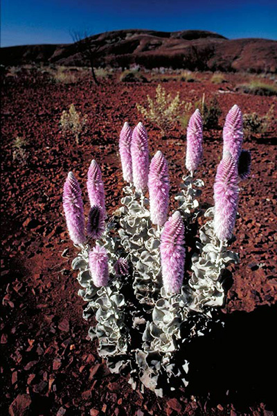
mug lair—an obnoxious exhibitionist, public nuisance. mug's game—any job, activity, enterprise that is unpleasant, unrewarding or held in contempt. mugga ironbark—Eucalyptus sideroxylon, a tall, spreading tree with black, deeply furrowed bark. The foliage is blue-grey and the trees have a pendulous growth habit. The flowering period is from winter to spring, and during this period the trees become covered with masses of deep pink flowers which are rich in nectar and thus visited by many native birds. In particular, the mugga ironbark is a major food source for the endangered regent honeyeater. The tree occurs in the north and north-west of NSW as well as in Victoria and Queensland. muggins—1. person who allows himself to be outwitted, talked into doing something unpleasant (often used by the speaker to refer to himself). 2. fool; simpleton; person with no mind of his own. muldoon—a fool; stupid person. Muldoon Aboriginal Land—one of two properties purchased by the Victorian government and vested in the Kerrup Jmara Elders Aboriginal Corporation. The other property is Allambie. Allambie and Muldoon are north and south respectively of the Lake Condah Mission, and border Mount Eccles National Park. mulesing—the removing of wrinkled folds of skin around a sheep's anal area to prevent fly and maggot infestation. mulga—originally, the word 'mulga' referred to a species of the Acacia family, especially the widespread shrub (or tree), acacia aneura, which has grey-green foliage, is regarded as useful fodder for grazing animals, and yields a distinctive brown and yellowish timber. The word is first recorded being used in this sense from 1848. The earliest citations are from the journals of white explorers, such as Mitchell and Stuart. Then the meaning of the word was extended more widely, until it virtually became a synonym for 'the bush'. And so you got such combinations as 'mulga country', 'mulga flats', and 'mulga paddocks'. The word comes from the Yuwaalaraay language – where it was probably something more like malga. These shrubs sometimes form fairly dense thickets and can dominate over large areas—they are very widespread across inland northern and central Australia. Though well adapted to burning, their normal response to fire is for the plants to be entirely consumed in the 'hot' fires which typify these arid regions. Then, in the cleared, ash-covered ground young plants will spring up rather quickly, reaching maturity within a few years or so. The small-patch burning which Aboriginal people have been conducting for tens of thousands of years or longer has helped to create and maintain the mosaic of different plant communities in different stages of succession, that characterize most of the bush—at least where traditional burning practices have been continued. mulga ant—the ant, Polyrachis macropus, of inland Australia which builds a mud nest to which mulga leaves are applied. mulga apple—large, edible gall produced by the mulga tree. Mulga Bill—a bush simpleton. mulga country—1. scrub or bush land. 2. the outback. mulga grass—any of several grasses of the family Poaceae, providing fodder. mulga ironbark—Eucalyptus sideroxylon, a tall, spreading tree with bark which is hard and furrowed, as is typical of ironbarks, and is deep brown to black in colour. The foliage is a dull greyish-green and is used for extraction of volatile oils. The flowering period is from winter to spring, and during this period the trees become covered with masses of deep pink flowers which are rich in nectar and are thus visited by many native birds. In particular, the mugga ironbark is a major food source for the endangered regent honeyeater. It is one of the best known of the ironbarks as there is an isolated population in the western area of Australia's largest city, Sydney. There are two subspecies recognised; subsp. sideroxylon is the common form found over most of the range of the species, except that it only has a very slight incursion into Victoria. Subspecies tricarpa is found along the south coast of New South Wales, the north-east coast of Victoria and in central Victoria. The latter differs from subsp. sideroxylon in having fewer flowers in its inflorescence, larger buds and fruit, and broader juvenile foliage. Mulga ironbark is a useful timber tree and its very hard wood has been used for heavy construction and railway sleepers. It is a tree which may be from 10m to 30m in height, is hardy in a wide range of soils and climates and is frost tolerant. Endemic to open forest of the western slopes and plains of New South Wales, extending into Queensland to the north and Victoria to the south. Mulga Lands bioregion—dominated by sandstones and claystones deposited in an inland sea about 100 million years ago. Sediments vary in thickness across the basement rocks, and they form the main water-bearing strata of the Great Australian Basin. Silcrete pebbles and boulders mantle the landscape as gibber, and massive silcrete often forms the low cliff lines on plateau and tableland margins. The region lies mostly within the Murray-Darling Basin and encompasses the Bulloo, Lake Bancannia, Warrego, Paroo, Darling, Barwon and Culgoa River catchments. Alluvial fans of the Paroo and Warrego river systems have deposited sands and clays between the plateau areas of sandstones. Grey and brown cracking clays in channels and claypans dominate this alluvial system. Lakes and swamps are normally dry, but all wetland systems are very important ecologically in wet years. This bioregion resides primarily within northern NSW, extending north and west into Queensland. mulga madness—the personal eccentricity attributed to the isolation of living in the outback. mulga mafia—a derisive term for the National Party, which represents country folk. mulga paddocks—paddocks in mulga country—or, the bush. mulga parrot—Psephotus varius, a small, bright, multicoloured parrot. The mulga parrot is quiet and unobtrusive, and is mostly encountered in pairs or small parties—rarely in flocks. It is erratically distributed across interior mainland Australia, from central NSW westwards, in arid woodland, especially mulga, but also mallee, cypress pine and box woodlands. It feeds on seeds of various grasses and herbaceous plants. Breeding is generally between August-December, but is dependent upon good rainfall. The usual nesting site is a cavity in a tree (as low as 2—3m above ground) or sometimes a fallen log or post. The female incubates the eggs whilst being attended and fed by the male. Both sexes participate in rearing the young. mulga scrub—Acacia aneura, one of the few acacias with a long life. It is also a good fodder tree, its wood is valuable for a variety of purposes and the tree grows in many parts of Australia. In favourable conditions young plants will grow at a rate of 1 metre every 10 years until the tree reaches its maximum height of 10m. Reduced rainfall or drought conditions, which are common, will slow this process or bring it to a temporary halt. As a result, a mature tree will usually be more than 100 years old. A sophisticated arrangement of its phyllodes and branches ensures that rainwater is channelled to the stem and onto the ground right to its deep taproot (seedlings of only 10cm height have been found to have taproots reaching 3m deep into the ground). To Aboriginal people Acacia aneura used to be one of the most important plant food sources. The seeds of the plant were separated from their pods by an elaborate process involving rubbing, threshing, parching and winnowing. The completely pod-free seed was then moistened with water and ground to an edible paste. A sweet exudation, produced by the plant after attack by a sap-sucking insect, was either sucked straight from the plant or dissolved in water to make a refreshing, sweet drink. This was also eaten by early settlers who referred to it as "bush lollies". The hard wood of mulga, which turns dark red-brown when polished, was turned into spear-throwers, spearheads, barbs, boomerangs and digging sticks. One such tool, a small, flat shield called "mulga" by one Aboriginal tribe gave the plant its common name. In the Northern Territory people suffering from colds and flu-like illnesses utilised an infusion of young leaflets and twigs as a wash. Leaves of the plant and small pieces of termite mound were layered over hot coals and the mother with her newborn child would lie down on top of a layer of branches and leaflets to sleep while the smoke and vapour passed over their bodies. In some areas, only leaves and twigs were used and no pieces of termite mound. To the stock of white pastoralists the tree provides shade, shelter and forage. Feeding, however, is not completely without problems. The high protein content of the foliage is not easily digested. After long periods of feeding on mulga, indigestible fibre balls have been found in sheep's rumen. Mulga wood was used extensively by the early settlers. It was particularly valuable for fencing, the production of charcoal and for building bullock yokes. The multitude of uses lead to massive clearings of mulga in some areas, further compounded by the devastating impact of feral goats. The disappearance of mulga usually goes hand in hand with a spread of grasses, thereby leading to increased termite activity, which may result in greater erosion during dry times. Furthermore, disappearing mulga decreases nitrogen levels in the ground, depriving other valuable desert plants of food. mulga snake—several species of the genus Pseudechis, large and dangerously venomous snakes that feed on mammals, frogs and reptiles. Queensland's 5th most deadly snake, found in dry eucalypt forests, woodlands and treeless plains in western and northern areas and near the east coast around Rockhampton and Townsville. To 3m, heavily built with wide head, back brown to olive-green, belly cream. mulga wire—1. bush telegrams. 2. an Aboriginal smoke signal. mulga-bred—reared in the country. mulgara—Dasycercus cristicauda, a rare marsupial distinguished by a crest of black hair along its tail. It is a fierce predator, feeding on large invertebrates, small rodents and reptiles, and is well adapted to living in sandy desert conditions. For example, by producing highly concentrated urine and dry faecal pellets it is able to obtain all its moisture requirements from its food. The extreme daytime heat of the desert is avoided by taking refuge in an extensive warren system, and they probably hunt at night. A mulgara attacks a mouse and other small vertebrates with lightening speed. It then devours the animal methodically from head to tail, inverting the skin in a remarkably neat fashion. It also is skilful at dislodging insects from crevices by means of its tiny forepaws. The mulgara's life span of at least six years is long by medium-sized marsupial standards. Females raise up to eight young in a poorly developed pouch. mulgra—1. a small spreading tree, Acacia aneura. 2. the wood of this tree. mulla mulla—(Ptilotus exaltus var. exaltatus) is one of the largest mulla mullas. The species is endemic to much of mainland Australia. This robust perenniel or ephemeral herb typically grows to a height of 1 metre (3.3 ft) tall but in a good season can grow to 1.5m (4.9 ft) tall and in poor years it may be only reach a few centimetres in height. There is a basal rosette of spathulate-oblanceolate smooth leaves up to 10cm long, the stem leaves being shorter. The flower spikes are up to 10cm long and 4cm across with loosely hairy flowers. The species is widespread from the North-West coast of Australia east into the Northern Territory, New South Wales and Queensland; and south-east to the eastern agricultural districts, Norseman and into South Australia. Mullaman beds—a raised plateau of lateritic rock, which is an erosional remnant of an almost continuous, lower Cretaceous cover known as the Mullaman beds, dominates the southern and western perimeters of the area of Arnhem Land. Low, uniform tablelands of this origin are a common feature of the north-western Australian landscape and cover a large percentage of the Arnhem Land surface. mullet—any fish of the family Mullidae (red mullet) or Mugilidae (grey mullet), usually with a thick body and a large blunt-nosed head, commonly used as food. Mulligan, James Venture—Irish-born explorer and prospector, responsible for opening the earliest Far North Queensland mineral fields. He discovered gold on the Palmer River in 1873; three years later he announced a new find on the Hodgkinson River, west of Trinity Bay. The Atherton Tableland, one of nature's outstanding accomplishments, was first seen by a white man in 1875 when Mulligan passed through on one of his many expeditions. mullock—rubbish, nonsense; and especially in the phrase 'a load of mullock', the word owes its existence to the goldmining sense of ‘mining refuse'. mullock over—shear (sheep) roughly. mullocker—clumsy, ineffectual person. mulloway—Argyrosomus japonicus, a large, pelagic fish which can be recognised by its silvery to bronze-green colouration, moderately elongated body, caudal fin shape and the series of pearly white spots along the lateral line. The caudal fin varies from pointed in juveniles to concave dorsally in adults. Maximum length 2m. Mulloway are usually seen on offshore reefs, but also live in shallow estuaries. In Australia this species is recorded from temperate marine waters of southern Queensland around the south of the continent and up to the central coast of Western Australia. Also known as jewfish. mullygrub—a grub, especially a witchetty grub. mullygrubber—(cricket) a bowled ball that hits the ground and rolls without bouncing. multiculturalism—refers to a policy developed in the '70s by Australian governments looking for a way of replacing assimilationist policies. It was based on the belief that society would work better if people felt their cultural beliefs were respected and that they did not have to abandon their values to be considered good Australians. Multiculturalism was put into operation after 1978, with a number of key programs – in media (the creation of the Special Broadcasting Service), in service delivery (access and equity), in employment (equal opportunity) and in wider social development (productive diversity). mum—(Brit.) mother; mom. Mumbulla Mountain—(Biamanga) was once used as an initiation site for young Aboriginal men, and still a sacred site to the Yuin people of the Sapphire Coast. The Mumbulla Creek waterfall and lagoon were used to wash off ceremonial ochre. Also known as the Father mountain it has strong ties to Gulaga, or Mother mountain. Mumbulla Mountain is located in the upper reaches of the Murrah River, within Biamanga National Park, 20km north of Bega in NSW. mummy—(Brit.) mother; mommy. mundarda—Cercatetus condinnus, a small marsupial. Genetic studies indicate that the closest relative of this species is probably the eastern pygmy possum, from which its ancestors diverged around eight million years ago. The mundarda is unusual among the members of its four-strong genus, as, unlike its grey relatives, the fur over most of its body is a bright cinnamon colour. It has pure white underparts, which also distinguishes it from its relatives, and has a relatively indistinct patch of darker fur in front of the eyes. It possesses larger, oval ears, large eyes, and long whiskers. The tail is long and prehensile, and is covered with fine scales, rather than fur. The hind feet have an opposable first digit, while all four feet have broad pads at the tips of the toes. Although small compared with most other possums, it is one of the larger pygmy possums, with adults ranging from 5.7-7.2cm in head-body length with a 7.7-8.7cm tail. Adult weight ranges from 8-21g. The female has a well-developed pouch, opening to the front, and containing six teats. At up to 1.2cm in length, the tongue is unusually large for such a small animal. It has a patchy distribution which includes south-western Western Australia as well as wheatbelt areas of South Australia, Kangaroo Island and Victoria south to Edenhope. It is also found in far south-western New South Wales, where it is listed as endangered. It inhabits semiarid woodland, shrubland and heath, dominated by plants such as bottlebrushes, melaleuca, banksia, and grevillea. While the species is no longer native to the area, fossils from the Nullarbor plain region are known. The mundarda is solitary and nocturnal. During the day they shelter in tree hollows or other natural crevices, birds' nests, or dense vegetation. During the night, they travel in search of food or mates, typically moving around 50m each day, and they may migrate to different areas over the course of a year, depending on local plant resources. They spend most of their time in the trees, using their grasping paws and prehensile tails to grip onto branches, grasp nest materials, and open flowers to access nectar, especially from plants such as melaleuca and eucalyptus, and may play a role in the pollination. It also supplements its diet with small amounts of insects. Native predators include quolls, snakes and owls. Mundardas have the ability to enter torpor during inclement or cold weather, enabling them to conserve energy and food reserves. During bouts of torpor, which may last for up to seven days at a time, body temperature falls to within one degree Celsius of ambient, and oxygen consumption to just 1% of normal. They sleep on their front, with their ears folded over their eyes, and the long tail coiled beneath their body. Mundardas can breed throughout the year, although they do so more commonly in the spring, and give birth to litters of four to six young. Although the mother often carries more than six embryos at a time in her womb, because she has only six teats, and marsupial young remain attached to an individual teat for much of their early life, this is the maximum number she is able to rear. Unusually, however, the mother may give birth just two days after weaning a previous litter, with her teats dramatically changing in size to accommodate the smaller young, and the mammary glands reverting to production of colostrum. The young are still blind when they leave the pouch at around 25 days of age; they initially remain within the nest, and are fully weaned at around 50 days. Females reach sexual maturity at twelve to fifteen months. Also known as south-western pygmy possum, western pygmy possum. mundowie—(in Australian pidgin) a foot, footstep. munga/munger—food. Mungaroona Range—the area lies north of the Fortescue River and consists of a dissected tableland from which rise the Sherlock and Yule rivers. The northern portion of the plateau ends abruptly at a rugged escarpment. Proterozoic basalt dominates the geology of the area, which is separated from the adjoining Chichester Range wilderness by a well-used station road. A hummock grassland of spinifex forms the dominant vegetation, with stretches of open woodland and shrubland along watercourses. Fauna within this area is thought to be representative of western arid environments, together with species associated specifically with the Pilbara region. The pastoral leases within the area are grazed at low stocking rates. Lands to the east of the area have been subject to mining for asbestos and copper, and mining exploration titles exist over much of the area. mungite—the nectar-rich, flowering spike, that becomes the woody cone of a plant of the genus Banksia. Mungo excursion—baked sediment from uneroded fireplaces in the Willandra Lakes region records the direction of the earth's magnetic field at the time the fire was used. About 31,000 years ago, the north-south axis moved 120° from its present position and returned again over several thousand years. This is called the "Mungo excursion". Mungo National Park—covers most of an ancient lakebed. During the last ice age, Lake Mungo was one of a chain of freshwater lakes strung along what is now Willandra Creek, which constitute the Willandra Lakes World Heritage Area. Around 50 million years ago, as the Eastern Highlands rose, this rocky inland landscape sank. The Murray, Murrumbidgee and Lachlan rivers transported water and sediment onto the subsiding landscape as the Australian continent slowly drifted northward into hotter, drier climes. About 400,000 years ago dry, windy conditions prevailed and the sluggish, meandering Willandra Creek was cut off, forming the Willandra Lake system. The westerly winds shaped the lake and created a lunette as the water receded. Between 25,000 to 45,000 years ago the lake covered 135sq km and was about 10m deep. The lakes dried up about 14,000 years ago. They are, however, an extraordinarily rich source of fossils. The remains of extinct creatures—Tasmanian tigers, short-faced kangaroos and zygomaturus—have been found here. Carbon dating has indicated that Aborigines inhabited the area 40,000 years ago, making it the site of the oldest known human occupation in Australia. From the lake they gathered mussels, Murray cod and golden perch. They also hunted wallaby and rat kangaroo and collected emu eggs. Today, the stark, silent and desolate landscape of sand, sparse vegetation and spiny, hard, pitted, crinkled and fluted dunes and ridges can look like a moonscape. Prior to being declared a national park in 1979, this land was part of Mungo sheep station. The park still contains a 45m woolshed, built by Chinese labour of local pine logs in 1869. Today, the vegetated dry lake basins are situated within dunes which have been stabilised by mallee-type vegetation. And a dune ridge known as the Walls of China rises to 30m above the plain and runs for some 30km around the old lake's eastern shore. Today, the pre-European birdlife is increasing, particularly pink cockatoos and chats and the striking mulga parrot. There are also kangaroos, emus and plenty of lizards. Munkan—Aboriginal people of Queensland. muntries—small, crunchy, apple-flavored berries found in South Australia. Also called native cranberries. Muntunjarra—a tribal group of the Umoona Community Council. Muralug Archipelago—(Prince of Wales Group) north of Cape York Peninsula, Queensland, is the home of the Kaurareg people. Their traditional country included the islands and the surrounding sea. Frequent visits were made to this area by people from other continental islands to the north, including Badu, Nagir and Moa, as well as Aboriginal people from the mainland. In 1921 the Kaurareg people who were then living on Kiriri (Hammond Island) were forcibly moved to Moa Island to the north. Some Kaurareg continued to inhabit Ngarupai (Horn Island) but plans to remove them to Moa Island in the 1930s were resisted. Murchison—the oldest town in northern Victoria, established in 1840 as an Aboriginal Protectorate. Squatters began taking up local land in the same year, and by 1850 the Protectorate had closed. The site became a river crossing used by goldminers travelling between the Bendigo and Beechworth goldfields in the early 1850s. Now a small rural town of some 600 residents, Murchison is situated on the Goulburn River in the lower Goulburn Valley. The Ngooraialum tribe (about 200 strong) occupied the land around Murchison before being devastated and dispossessed by the arrival of Europeans. Murchison bioregion—mulga low woodlands, often rich in ephemerals, on outcrop hardpan washplains and fine-textured Quaternary alluvial and eluvial surfaces mantling granitic and greenstone strata of the northern part of the Yilgarn Craton. Surfaces associated with the occluded drainage occur throughout with hummock grasslands on Quaternary sandplains, saltbush shrublands on calcareous soils and samphire low shrublands on saline alluvia. Areas of red sandplains with mallee/mulga parkland over hummock grasslands occur in the east. Murchison Range—joins the Davenport Range to form a barrier between the woodland savannah of the north and the arid desert of the south. The rare Johnson's mouse is endemic to rocky country, primarily within the Murchison Range. The Murchison and Davenport ranges together form a distinct bioregion within the Northern Territory. The Murchison Range is located south-east of Tennant Creek. Murchison River—an intermittent river on the Yilgarn Plateau, within the Kalbarri National Park. Broad, indiscernable drainage lines merge near the coast to form the single main channel of the Murchison River, which then meanders through a deep, gorge-like valley in an otherwise flat landscape. The gorge was carved in the Tumblagooda Sandstone in ancient times, when the river’s flow was heavy and swift. The sandstone has contrasts of brownish red and purple against the bands of white, and the layers are rich with trace fossils dating back to the dawn of life. Now, the Murchison River exhibits dry, sandy riverbeds for most of the year, filling and flowing only after cyclonic rainfall. At that time, the river discharges directly to the ocean near Kalbarri, which is frequently closed with a sand-bar extending across the river mouth. Murgon—a 55-million-year-old fossil site in southern Queensland. This site has yielded a range of marsupial fossils, many with strong South American connections. There is also evidence of a placental mammal, known as a condylarth. Placental mammals were also found in North America and South America at this time. Australia was linked to South America via Antarctica when Australia was part of the ancient land of Gondwana. This connection also enabled Australia's fauna to migrate, with the result that a platypus has been found in 63-million-year-old rocks in Patagonia, South America. Five years ago the science magazine Nature reported that the tooth of a placental condylarth had been found in Australia. The presence of the placental condylarth in Australia suggests that marsupials and placentals were in Australia at the same time and that in the battle for supremacy, the marsupials won. Recently, a similar but larger placental condylarth tooth has been found at the Murgon site. Murgon has also provided fossils of one of the world's oldest bats as well as the world's oldest songbird. Murinbata—Aboriginal people of the Northern Territory. murphy—a potato. Murphy's Haystacks—the pillars and boulders in their present-day form are only about 100,000 years old, but the granite itself goes back 15 million years. The formations were formed by the uneven weathering of crystalline rock as densely fractured compartments broke down through weathering more quickly than massive unfractured compartments. The distinction between the two forms is that pillars merge unknown with the underlying bedrock, but boulders are clearly detached. The haystacks are of a pink granite named Hiltaba granite after the homestead of the same name in the Gawler Ranges. It is extensive over the north-western Eyre Peninsula. The mottled colours on the surface of the haystacks are caused by growth of lichen, a tough plant organism which thrives on exposed granite. The granite hills of the district, including the haystacks, were buried by calcareous dune sand about 30,000 years ago. Subsequent erosion of the surrounding land surface has gradually revealed the forms we see today. The rock formation was named when the driver of a mail run—named Murphy—stood up and saw a grouping of pillars which to him looked like haystacks shimmering in the hot afternoon sun. "That man must harrow", he commented, "look at all the hay he has saved". Located on the Eyre Peninsula, South Australia. Murramarang National Park—the park includes coastal pockets running from Pretty Beach to North Durras and from South Durras to North Head at Bateman’s Bay, and an area bordering Durras Lake. Its most famous asset is Pebbly Beach, where kangaroos sunbathe on the beach and have been known to enter the water. Generally, these roos lounge around, waiting to be pampered by their visitors. Many walking tracks are marked throughout the park, and accommodation is available in a variety of styles, including cabins and camping grounds. Situated at the southern end of the Shoalhaven area. Murray, Lt John—first mate on the Lady Nelson under Lieutenant Grant on the voyage to Western Port (1801), where he assisted in surveying the harbour. Murray was appointed to act as Lieutenant-commander of the Lady Nelson in place of Grant. Murray voyaged to Norfolk Island, and on his return was instructed by the governor to finish the exploration of the south coast that had been insufficiently carried out by Lt. Grant. In this capacity, Murray discovered Port Phillip and Point Nepean. On 8 March, 1802, Murray formally took possession of the port in the name of King George the Third. He left Port Phillip on 12 March and was back in Sydney 12 days later. On 22 July the Lady Nelson sailed with the Investigator under Captain Flinders on a voyage to the north coast of Australia, but it was difficult for the smaller vessel to keep up with the Investigator, and towards the end of November Murray was given orders to return to Sydney. Murray Basin—an area of low relief with deep unconsolidated sediment. Cainozoic rocks form a cover to infra-basins containing Early Cretaceous, Permian, and minor Late Carboniferous sediments. The basin, which deepens to the south-west, is bordered to the north and east by Proterozoic and Palaeozoic rocks. In the west the landscape is predominantly aeolian, consisting of sandy ridges interrupted by clay pans and lunettes. In the east the present surface is a relict landform representing the final phase of prior stream deposition and aggradation, principally of the Murray and Murrumbidgee river systems. Located in the south-west portion of New South Wales. Murray cod—the large groper-like fish, Maccullochella peeli, of the Murray-Darling river system. Murray floodplains—the floodplains of the Murray River are a potential source of salt and other contaminants to the river, due to their role in intercepting saline groundwater discharge. The roles of surface water-groundwater interactions in wetland soil and water chemistry, and the resultant biotic responses are poorly understood. The connectivity of the surface and groundwater depends on regional hydrogeology and wetland geomorphology, and will also be affected by operations such as wetland wetting-and-drying cycles and groundwater interception. Regional groundwater is highly saline, anoxic and reduced, impacting wetland water quality and habitat. Vegetation along the floodplains has been shown to be in a severe state of decline. In South Australia, where vegetation losses have been great, regeneration is limited and may result in not only individual tree losses but also widespread population decline. The amount of time growth stages for each species has been found to be greatly reduced under regulated flows compared to natural flows. This has resulted in shifted localized regeneration patterns corresponding with river red gum's greater demand for inundation than for black box. Moderate magnitude flows have been most impacted by regulation, and consequently these are the very flows needed for floodplain tree population maintenance. Murray Grey—developed in Australia during the last century, and first imported to the United States in 1970, the Murray Grey combines the best traits of its parent breeds into a very unique, all beef breed. Murray Grey cattle have the excellent temperament, thriftiness and meat tenderness of the Shorthorns and the marbling traits of the original Scotch Aberdeen Angus. Murray Greys display better temperament than most breeds of cattle. They respond very well to good handling practices. Being a true beef breed and being of moderate size, the Murray Grey is also one of only a few breeds that can consistently finish to Choice on grass, making this breed an excellent choice for producers looking to market into the high value, health-conscious, grass-fed, retail market. They are renowned for their calving ease—many owners never have to pull a calf. They are polled and often remove 100 percent of horns on the first cross, even on Bos indicus cattle. Murray Grey cattle have dark skin pigment: grey muzzles, grey around the eyes and grey teat ends. This dark pigment helps prevent infectious pinkeye, and cancer eye is unknown in the breed. The grey teat ends eliminates the teat chapping and sunburned udders that can be a stockman’s nightmare. Murray Island—(Mer) a small island of volcanic origin, populated by the Melanesian Meriam people and situated in the eastern section of Torres Strait, near the Great Barrier Reef. The island has a population of around 450. Formed from an extinct volcano, Murray Island has red, fertile soil and dense vegetation. The highest point of the island is Gelam Paser (230m). The island has been inhabited by the Meriam people for thousands of years prior to European settlement of Australia. Westerners began to settle on the island in 1872 when the London Missionary Society founded a missionary school there. The Queensland government annexed the islands in 1879. During World War II, Japanese submarines regularly visited Murray Island to collect food and water and to avoid detection by Allied ships. Murray Island's most famous resident was trade unionist Eddie Mabo, whose decision to sue the Queensland government in order to secure ownership of his land, which had been removed from his ancestors by the English colonial powers using the terra nullius legal concept, ultimately led to the High Court of Australia, on appeal from the Supreme Court of the State of Queensland, issue the Mabo decision to finally recognise Mabo's rights on his land on 3 June 1992. This decision continues to have ramifications for Australia. Unfortunately, Mabo himself died a few months before the decision. Murray perch—any of several freshwater fish of the Murray-Darling river system. Murray River—Australia's longest river was discovered by Hume and Hovell, who reached it at a point above Albury in 1824. Hovell named it the Hume after Hume's father, but when Captain Sturt made his voyage to the Murray mouth in 1830, near present day Goolwa, he named it the Murray, after the then Secretary of State for the Colonies. The publication of Sturt's account in 1832 indirectly resulted in the establishment of South Australia in 1836. Early attempts to navigate the river were almost as dangerous as the voyage by sailing ship from Europe. They were not successful until 1852 when the government offered a bonus of $8,000 for the first paddlesteamer to reach Echuca. This was achieved by both William Randell and Francis Cadell. The Murray River and its surrounding region has become the state's most important primary producing area. Murray River crayfish—Euastacys armatus, the second largest freshwater crayfish in the world. The species occurs in the Murray River throughout most of its length and major tributaries in Victoria (including the Goulburn, Yea, Murrundindi, Jamieson, Howqua, Ovens and Mitta Mitta rivers) and New South Wales (including the Murrumbidgee, Cotter and Macquarie River). The range extends over 800km east-west. The most northerly known site of the species is near Kandos, 160km west of Newcastle, NSW. This site indicates a north-south range of approximately 450km. Euastacus armatus inhabits large and small streams in a variety of habitats, including cleared pasture and dry and wet sclerophyll forests (vegetation usually densest along upper reaches of streams) at altitudes from close to sea level to over 700m. Also known as spiny lobster. Murray River Tribes—Aboriginal people of the New South Wales, Victoria and South Australia. The Jaitmatang tribe are the traditional owners of much of the country north of the Great Divide in the upper headwaters of the Murray River. Other tribes include the Wiradjuri, Baraba Baraba, Yorta Yorta, Wemba Wemba, Wadi Wadi, Dadi Dadi, Latje Latje, Waveroo, Kureinji, Barkindji, Meru, Ngarrindjeri and Ngurraiilam. Murray Valley encephalitis—the virus (MVEV) is a zoonotic flavivirus endemic to northern Australia and Papua New Guinea. It is the causal agent of Murray Valley encephalitis (previously known as Australian encephalitis) and in humans can cause permanent neurological disease or death. MVEV is related to Kunjin virus which has a similar ecology but has a lower morbidity rate. Although the arbovirus is endemic to Northern Australia, it has occasionally spread to the southern states during times of heavy rainfall during the summer monsoon season via seasonal flooding of the Murray-Darling river system. MVEV is a mosquito-borne virus that is maintained in a bird-mosquito-bird cycle. Water birds from the Ciconiiformes order, including herons and cormorants, provide the natural reservoir for MVEV. The major mosquito vector is Culex annulirostris. Human infection occurs only through bites from infected mosquitoes; the virus cannot be transmitted from person to person. The first epidemics of MVE occurred in 1917 and 1918 in South Eastern Australia following years of high rainfall. The virus was isolated from human samples in 1951 during an epidemic in the Murray Valley, NSW. The New South Wales government has placed 'sentinel flocks' of chickens near known bird breeding sites as an early warning system. These flocks are tested for MVE during the mosquito breeding season. Murray whaler—a swagman whose course follows the route of a river. Murray-Darling Basin—a vast inland river system of South Australia, encompassing roughly 14% of the continent's total area. Crucial to the economic development of the nation since colonial times, Australia relies heavily on the land and water resources of the Murray-Darling for agricultural production. Almost two million people live within the basin, and a further one million residing outside the basin are heavily dependent on its water. From its source in the Snowy Mountains, the water travels nearly 2,000km before reaching the South Australian border. Its water supplies fifty per cent of the consumption in Adelaide; and almost all, in towns as far away as Port Augusta and Woomera. The Murray-Darling Basin is characterised by meandering rivers and vast floodplains supporting a large number of wetlands, which in turn support a high biodiversity. Many of the basin's wetlands are also recognised as internationally important habitats and breeding grounds for migratory waterbird species. They are represented on the Ramsar List of Wetlands of International Importance, the Register of Australia's National Estate, and the Directory of Nationally Important Wetlands. The Murray-Darling Basin has, since June of 1995, been subject to an agreement to cap water usage. Aboriginal people have been present in the Murray-Darling Basin for at least 40,000 years. Murri—the Aboriginal people of southern Queensland or northern New South Wales. From the Kamilaroi language of northern NSW and many southern Queensland languages, mari meaning 'an Aboriginal person'. Murrumbidgee pine—the tree, Callitris glaucophylla. Murrumbidgee River—a 1690km-long tributary from the Murray-Darling Basin, originating in the Snowy Mountains. The Murrumbidgee passes through the ACT before working its way across NSW eventually to join the Murray on the border between NSW and Victoria. In the ACT the Murrumbidgee flows north along the western margin of the developed residential area of Canberra where it is joined by the Cotter and Molonglo rivers. Within this region it is mostly fast-flowing over rapids, but in several parts it is quite deep and calm. In the south the river passes over relatively flat and open countryside, but from around Kambah Pool it winds through deep, tree-lined gullies abounding in bird life. The banks are mainly sandy beaches and are dotted with willows and casuarinas. Murrumbidgee is an Aboriginal word meaning "never-failing". In 1829, Captain Charles Sturt and his party sailed down the Murrumbidgee in a whaleboat, intent on solving the riddle of the western rivers: Did the rivers flow in to an inland sea? Today the Riverina-Murrumbidgee Irrigation Area is recognised as one of Australia's main food-producing areas, famous for its fruit, rice, wine, cereal crops, dairy produce, vegetables, livestock and wool. Murwillumbah—a small town located nearly exactly in the middle of the Mount Warning caldera. Alluvial soils, washed down from the slopes of the eroding volcanic outcroppings, support the production of sugar cane, mixed small crops and vegetables. The surrounding foothills have dairy and beef farms, along with bananas, and fruit and nut orchards. Much of the volcanic slopes are cloaked in dense forests of mixed sclerophyll eucalypt and rainforest types, most of which are reserves or national parks. The heights are primarily protected as World Heritage-listed National Parks. Murwillumbah is the seat of the Tweed Shire Council and the commercial centre for the smaller villages and residential developments in the valley. Located in New South Wales, close to the Queensland border. mushie—mushroom. musk duck—Biziura lobata, the male is the largest of Australia's ducks (up to 73cm) and has a powerful build; the female is 47 to 60 cm. Both male and female musk ducks are sooty-brown in plumage, with paler brown barring on the body and fine spots on the head. They are paler below, becoming whiter towards the abdomen. The male is decorated with a large, bulbous lobe of skin hanging under his bill. This sac increases in size at the start of the breeding season. The female also has a much-reduced lobe on the underside of its bill, only visible at a short distance. The bill is dark grey in both sexes and the eye dark brown. The tail is a collection of long, stiff feathers, which can be held in a fan-shape. Musk ducks get their name from the musky odour produced from a gland on the rump. musk lorikeet—Glossopsitta concinna, is a largish lorikeet 22cm in length. It has an overall dark green plumage with blue tinge on the crown of the head and olive/ bronze on lower back of neck. There are bright red patches on the forehead and from under each eye to the upper/side of the neck; the beak is overall black with a tan/brown tip. The head is a distinctive shape with the red patched brow protruding. Wing feathers are red tipped and tail is yellow/green. Eyes are light brown to dull orange, feet green/olive to brown. The species inhabits mainly eucalypt forests and woodlands in coastal areas from southern Queensland through New South Wales and Victoria to South Australia. They are common to abundant in the south, but rare north of Sydney. Their favoured food is eucalyptus flowers (pollen and nectar). They are greedy feeders and become so engrossed when feeding they appear to ignore approaching danger—even when being shot they can be reluctant to leave the tree they're feeding on. They nest anytime from August to January and have 2 eggs. They are a nomadic bird and can suddenly arrive in their thousands if food is scarce elsewhere. In poor seasons when the eucalyptus trees fail to flower, musk lorikeets can be a serious problem to farmers—frenzy feeding on fruit crops with almost suicidal intent. Breeding is mostly August to January. It is a peaceful bird and appears to exhibit no aggression, even during the breeding season. Other names: red-eared lorikeet, green keet. musk tree—Olearea argyrophylla, commonly known as daisy tree. musky rat-kangaroo—Hypsiprymnodon moschatus is unique in the Macropod family for it's bounding rather than hopping gait—more like a rabbit. Kangaroos evolved from possum-like ancestors, but any similarity to possums has disappeared in modern kangaroos—except for the musky rat-kangaroo. It retains a number of possum features, including a great toe or hallux on the hind feet and a system of gripping grooves on its foot pads. This marsupial is the smallest kangaroo in the world, weighing only half a kilogram and no bigger than a large guinea pig. It regularly gives birth to twins, unlike other kangaroos, and is active during the day foraging on the forest floor for fruits and seeds as well as fungi & vertebrates. At night it sleeps in a nest of leaves and generally keeps to itself. Sometimes groups are seen under fruiting trees. They inhabit almost the entire wet tropics, both lowland and upland forest and are found nowhere else. muso—musician. must have hollow legs—pertaining to a person who eats a great deal but never seems to put on weight. muster—1. collect (orig, soldiers) for inspection, to check numbers, etc. 2. collect, gather together. 3. round up (livestock). 4. (colloq.) attendance (at a meeting, etc); e.g. Had a good muster. muster-book—(hist.) a book for registering convicts. Mutawintji National Park—colourful gorges, rock pools and creek beds lined with red gums dissect the rugged, mulga-clad Byngnano Range. Scattered among the caves and overhangs are galleries of Aboriginal rock art and engravings. The park was returned to its traditional owners in 1998 and is held on their behalf by the Mutawintji Local Aboriginal Land Council. Visitors most commonly accompany guides into the areas where Aboriginal rock art can be seen and photographed. Guides also tell stories of Dreamtime legends relating to the creation of the landscapes. Mutawintji National Park (68,912ha) is located 130km north-east of Broken Hill, NSW. An area known as the Mutawintji Historic Site (486ha) was the place where initiation, rainmaking and other ceremonies were held. Muttaburrasaurus—was first found on Rosebury Downs station beside the Thompson river near the town of Muttaburra in Queensland, in 1963. The fossil remains had been scattered about by the feet of cattle for years and some of the locals had taken pieces home with them. Once the importance of the find was known the locals were asked to return the material they had souvenired, and most was recovered. At its time it was the most complete dinosaur skeleton found in Australia (now surpassed by Minmi paravertebra, an ankylosaur from the same region). It was a herbivore similar to Iguanodon (if not closely related) that spent most of its time on all fours, but could raise up onto its hind legs to feed or to run fast from predators. It had an unusual wide, low skull with a hollow chamber on top of its snout. It may be related to the dryosaurs, including the basal ornithopod Gasparinisaura cincosaltensis from the Late Cretaceous of South America. There seem to be many basal dryomorph dinosaurs known from Gondwanan countries. The jaw muscles of Muttaburrasaurus would have been unusually strong. Unusual for a dinosaur, Muttaburrasaurus seems to have replaced its teeth all at once, rather than one at a time as needed, so that the tooth row formed a continuous shearing surface rather than a grinding one. Perhaps these adaptations were for eating tough vegetation that other dinosaurs found difficult to chew, such as cycads, which were common in this part of Australia at the time. Muttaburrasaurus seems to be one of the most widespread dinosaurs known from Australia. Although Muttaburrasaurus seems to be neither iguanodontid nor a hadrosaur, it may represent a line of ornithopods that diverged from the iguanodont-hadrosaur line some time before the divergence of Tenontosaurus. mutton-head—stupid, foolish person. muttonbird—1. Puffinus ternuirostris is one of the world's greatest travellers, migrating from southern Australia up the western side of the Pacific Ocean to the Arctic region, where it spends the northern summer and then returns southwards through the centre of the ocean. This remarkable bird covers 15,000km in each direction annually. Along this journey the muttonbirds feed upon krill, squid and fish. They return from south-east Asia to the Solitary Islands in order to breed from August, using the same burrow each year, with a single egg laid by December. By mid-May, the muttonbirds have begun their annual migration. Also known as short-tailed shearwater. 2. someone from Tasmania, in colonial times. Muttonbird Island Nature Reserve—this island, connected to the coast of New South Wales at Coffs Harbour, is extensively tunnelled by over 20,000 muttonbirds, which breed on the island each year. Wedge-tailed shearwaters, commonly known as muttonbirds, are one of the eight shearwater species found in New South Wales, and this is the most significant muttonbird site in the state. Muttonbirds travel thousands of kilometres from South East Asia, returning from their annual northerly migration each August. Some settle at Muttonbird Island, others in the Lord Howe Island group and elsewhere on Australia's east coast. By mid-November, the courtship period is over and birds have paired and mating begins. Muttonbird is just one of the Solitary Islands group that are part of the Solitary Islands Marine Park. muttonbirding—traditional Aboriginal hunting for the short-tailed shearwater (mutton-birding) takes place in a five-week season at the end of March through April. Big Dog and Babel Wandsore islands claim to have formed the basis for a viable mutton-bird industry. At present most of the mutton-bird industry is run by whites who exploit Aborigines' desire to go mutton-birding through providing very low wages and poor living conditions. In addition, too many birds are taken in a season and their numbers are decreasing. my bloody oath/colonial/colonial oath!—expression of total agreement; emphatically yes! myall—1. (hist) strange or hostile. 2. (of an Aboriginal person) inexperienced in European ways. 3. wild (plant or animal). 4. Acacia pendula, a widespread tree of inland areas. Grows in major river floodplains and the Riverine Plain, often in large stands, sometimes as the dominant species on heavy clay soils. Foliage has a distinctive weeping habit and glaucous ("blue-green") colouration, and is relatively palatable to livestock. During drought, trees are lopped for fodder. Myall Creek Massacre—settlers of the Nandewar region of New South Wales had pushed the Indigenous community away from creeks and waterholes, and seized their women and girls. The Aboriginal men retaliated by spearing stock and attacking the stations. The Myall Creek massacre was one of many such in the region, but it was the first instance for which white men were punished for the murder of Aboriginal people—7 of 11 local stockmen and station hands involved were hanged. Myall Lakes National Park—the largest coastal lake system in NSW. An important waterbird habitat, the park is listed under the Ramsar Convention of Wetlands of International Significance. It has 40km of beaches, lakes fringed with paperbark trees, and possibly the tallest tree in NSW, the Grandis, a magnificent 76-metre-high flooded gum. There is a rainforest walk at Mungo Brush, and 4WD beach-driving is permitted between Hawks Nest and Big Gibber. Situated on 31,562ha, the park is located 236km north of Sydney. Myora Mission—(see: Stradbroke Island). myrtle beech—Nothofagus cunninghamii, the dominant species of the cool temperate rainforest. As one of the plants that evolved on the supercontinent of Gondwana, the myrtle beech once grew throughout Australia and the southern continents of South America and Antarctica. Today, the species finds its stronghold in the Australian island-state of Tasmania. Myrtle beech can attain heights of up to 50m and ages in excess of 500 years. myrtle wattle—Acacia myrtifolia, usually a shrub from 1-2m high by a similar width but some almost prostrate forms exist. A reasonably distinctive feature is the reddish stems of the plant giving rise to the alternative common name red-stemmed wattle. Like most members of the genus, the mature plant does not have true leaves but has leaf-like flattened stems called phyllodes. In A. myrtifolia the phyllodes are elliptic and usually slightly curved. They are usually up to 50mm long by about 25mm wide with prominent veins along the margins and the midrib. The cream flower clusters are globular in shape and occur on short racemes from the leaf axils in spring. A. myrtifolia was one of the earliest Australian plants brought into cultivation in Europe. myrtle wilt—a fatal disease of myrtle beech caused by the fungal pathogen Chalara australis. The disease develops initially in a stand of beech through the infection of stem or root wounds, via air- or water-borne inoculum. Scientific studies in Tasmania have demonstrated that heavy machinery used to build logging roads and clearfell forest adjacent to stands of cool temperate rainforest is increasing the wounding rate of myrtle beech and artificially elevating levels of myrtle wilt. Infection of wounds will first cause wilt symptoms and ultimately lead to the death of the whole tree. Infected trees take between six months and 3 years to die. mystery bags—(rhyming slang) snags; sausages. myxo—myxomatosis. myxomatosis—a disease that affects rabbits and is caused by the Myxoma virus. It was first observed in Uruguay in laboratory rabbits in the late 19th century. In Australia, the virus was first field-tested for population control in 1938; a full-scale release was performed in 1950 in an attempt to control the rabbit population. At first, normally the disease is visible by lumps (myxomata) and puffiness around the head and genitals. It then may progress to acute conjunctivitis and possibly blindness; however, this also may be the first indication of the disease. The rabbits become listless, lose appetite, and develop a fever. Secondary bacterial infections occur in most cases which cause pneumonia and purulent inflammation of the lungs. In cases where the rabbit has little or no resistance, death may take place rapidly, often in as little as 48 hours; most cases result in death within 14 days. It was devastatingly effective, reducing the estimated rabbit population from 600 million to 100 million in two years. However, the rabbits remaining alive were those least affected by the disease. Genetic resistance to myxomatosis was observed soon after the first release and most rabbits acquired partial immunity in the first two decades. Resistance has been increasing slowly since the 1970s, and the disease now only kills about 50% of infected rabbits. In an attempt to increase that number, a second virus (rabbit calicivirus) was introduced into the rabbit population in 1996.
|